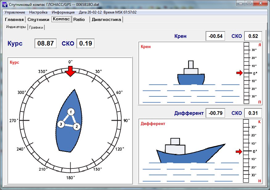
Satellite Compass
Software “Satellite Compass” controls the system for the object space orientation with the help of...
More info
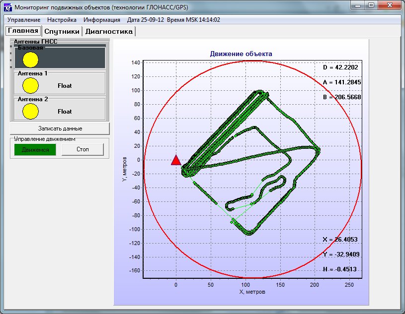
Precession Differential Navigation Systems for the Mobile Objects
Processing of the GNSS signals from GLONASS, GPS and Galileo by the single set of the receiving...
More info

Monitoring systems for the building/infrastructure deformation, slopes and mobile grounds
The main purpose of the system is the permanent any weather monitoring of the natural and...
More info